Martin Manley: My Life and Death
Born 8-15-53, Died 8-15-13 , Age 60
- Home Page
- January 1, 2012
- June 11, 2012
- Suicide Preface
- Why Suicide?
- Why not?
- Why Age 60?
- Self-Serving?
- Suicide - How 2
- Gun Control
- Other Suicides
- Other Quotes
- ------------------------------------
- Growing Up
- OMG: I look 60!
- Mom and Dad
- The Heavens
- My Religion
- Chancel Choir
- Victory O Lord
- The Proposal
- Two Marriages
- First Two Loves
- Pictures
- Trips and Travel
- Writing Fiction
- Music & Poetry
- Movies & TV
- Health
- Sleep Deprived
- Living Donor
- Food & Drink
- Creations
- Sports
- KC Star
- KC Tornado
- My IQ
- Synesthesia
- Poker
- Legal
- JOCO, Ks.
- U.S. Financial
- 911 & Conspiracies
- COOL STUFF
- Births & Deaths
Viewfinder and Microwave Maps
In the early 1980’s I and my partners had a Satellite TV company. This was an embryonic industry and there was plenty of opportunity to come up with something new that had not been done before. I actually came up with two products for the company that did not exist anywhere in the industry at the time.
The first was something called a Viewfinder. In those days there were only a few satellites that the home owner would want to aim his dish at. The problem with Satellite TV systems is that it is dependent upon direct line of sight. In other words, if there is an obstruction between the dish and the satellite in the sky, the signal won’t reach the dish and the homeowner won’t get to watch anything.
Naturally, before an installer walked away from the job, the homeowner would have a picture. But, what would often happen is that trees would grow or they would put on leaves in the spring. The signal might have been fine at one point, but not so much later. Of course, buildings completely blocked the signal.
When the salesman went to the house to survey the situation, he more or less knew where the satellites were at. So, if he stood in a back yard and was confident of north and south, he could guess that the line of site was okay. But, guessing is risky – especially when the first thing that is done is to dig a hole and place a steel pole in concrete. If the salesman had his directions or angles wrong, the system would not work and all that work would have to be redone.
I realized one day that there should be a way to do what the dish did – meaning, have a tool that would locate the satellite before any work was done.
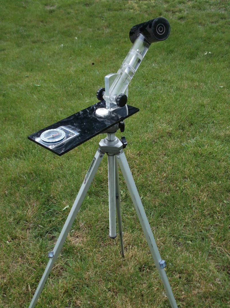
So, I came up with a tool that was on a tripod that had a bubble level and a compass. It also had an adjustment for the latitude and longitude where it was being employed as well as that location's magnetic declination. In addition, the sighting tool would pivot to follow the Clarke Belt. That’s where all the satellites can be found 22K miles above the equator.
Once everything was set up, the person simply eyed the arc and could see what the dish would be "seeing"… ahead of time. My original device was made out of wood and my partner Charles developed it to be made out of plastic. We later sold thousands of these Viewfinders around the country to STV retailers saving them a lot of time, guesswork and misery.
-------------------
A related item was something I called Microwave State Maps. Once again, I invented this product out of personal necessity. The only other problem besides obstructions for STV systems was something called microwave interference. This was usually a line of sight signal sent from one Ma Bell tower to another. If you happened to want to put a dish between the two towers, the interference would seriously degrade your signal from the satellite. Naturally, a dealer did not want to sell a system to Joe Blow, go to the trouble to install it, and only then find out that his customer couldn’t have a dish because of the interference.
There were things that could be done such as shielding, but as a rule, it was a major problem if your customer was between two such towers. I researched where all the towers were in NE Kansas and plotted the paths on a map. As a rule, the interference track was about a mile wide. We knew if the customer was outside of that path they were fine.
One thing led to another and I started researching other states. Eventually, we had most of the major states – especially those in the Midwest where our largest dealer base was located. We reproduced the state maps as blueprints with all the towers listed and all the mile-wide paths shown. That way a dealer in Springfield, Illinois could simply order a map of his state and he would be confident that he knew where there would be interference and where he would be safe from it.
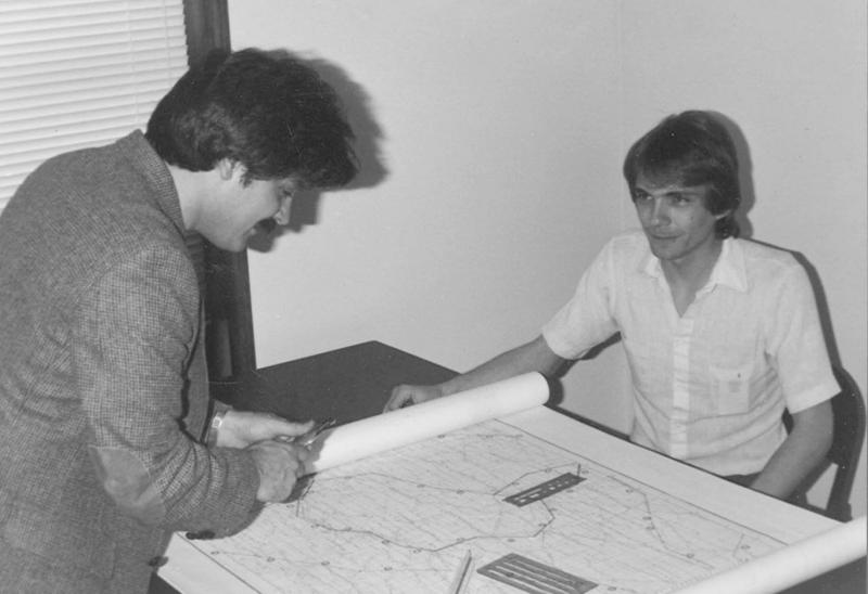
I don’t recall how many of these we sold, but it was in the many hundreds – if not thousands. The picture below shows me working on one of the state maps with an employee in 1985.

Copyright 2013 Martin Manley Life and Death. All rights reserved.
